
Blog: Field notes from Greenland: The way to Kanger
Though Greenland may seem to be one of the most remote places on earth, it’s quite centrally located within the North Atlantic.
In theory, flying to New York or London from Kangerlussuaq, on the island’s west coast, would take only about 5 hours. Many of the science support staff working here cut their teeth in Antarctica but decided to relocate to Greenland, especially as they and their parents grow older. It’s possible to reach home in the U.S. from Greenland within a couple of days, and even on the same day if you’re lucky – whereas in Antarctica, you can get stuck in the field for a week.
Kangerlussuaq (which means “long fjord” in Greenlandic, and is called “Kanger” for short and Søndre Strømfjord in Danish) is the only international airport in Greenland, as it’s the only place with a runway long enough for jumbo jets to land. Even the capital, Nuuk, doesn’t have an international airport, perhaps one of the sole world capitals with such a distinction. Kanger isn’t much in the way of a town, as there are only about 550 residents. In contrast, the coastal town of Sisimut, at the end of the fjord leading to Kanger, supports a population ten times larger. Life in Kanger pretty much revolves around the airport, while science support also plays a significant role and military installations historically have as well.
The only regularly scheduled international flights from Kanger are to Reykjavik and Copenhagen. In the summer, Air Greenland, the national carrier, also operates a flight to Iqaluit, Nunavut, Canada, which just had its last run of the season earlier this week. A lot of trans-Atlantic flights happen to divert to Kangerlussuaq in the case of an emergency, thanks to its large runway and generally clear skies. The favorable weather, in fact, was one reason why U.S. engineers decided to build an air base here, called Bluie West-8, in 1942. Another motivation was Kangerlussuaq’s location, which is much farther inland than most settlements in Greenland. Situated some 60-odd miles up the fjord, this is why the town is not as afflicted by inclement coastal weather – and why nowadays, Kanger is popular with scientists who want to be able to reach the ice sheet by vehicle. The reason that the U.S. was building air bases in Greenland in the first place was because in 1941, after Denmark fell to the Nazis during World War II, the Americans took over responsibility for Greenland’s security.
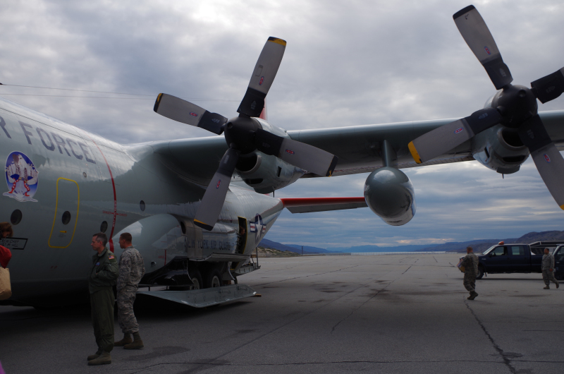
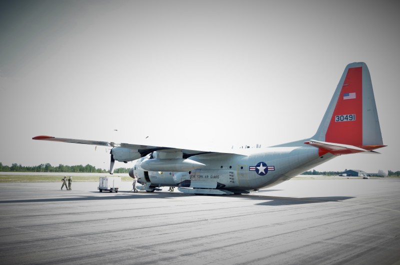
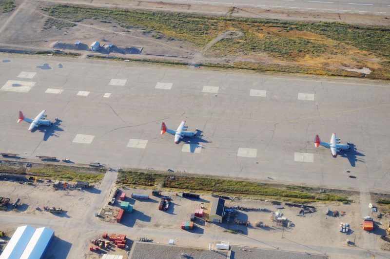
So, leaving aside the fantastical depiction of a direct New York-Nuuk Air Greenland flight in last year’s film The Secret Life of Walter Mitty, without any commercial flights from the U.S. to Greenland, how do American scientists and researchers get to this big icy island in the middle of the North Atlantic? Air Greenland did, in 2007, operate a Kangerlussuaq-Baltimore flight, but it is no more. One option, then, is to fly commercially, which generally requires traveling to Copenhagen and then onward to Kanger on the daily Air Greenland flight. But the preferred option is to fly with the U.S. Air National Guard. The 109th Airlift Wing flies C-130 planes during several flight periods each summer from Stratton Air National Guard Base in Scotia, New York to Kanger, often stopping in Goose Bay, Labrador, Canada in between. Researchers flying to Greenland with the ANG, as it’s called, look forward to the Goose Bay pit stop for its ice cream, though when we stopped there to refuel, they unfortunately didn’t have any. The C-130 flight departs Scotia early in the morning, and a neat clock in the waiting room tells you the time in Greenland, Antarctica – where the 109th Airlift Wing also supports Operation Deep Freeze during austral summers – and Zulu for good measure.
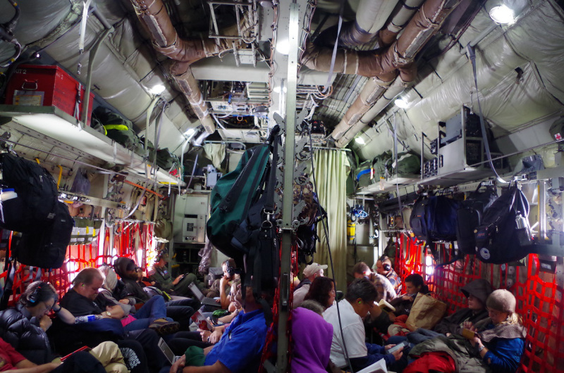
All passengers must wear ear protection on board due to the roar of the plane, and passengers are packed in like sardines, knees to knees. I guess it’s the last bit of claustrophobia one will experience before being released into sparsely populated Greenland. Personal carry-on bags hang above the passengers, while the rest of the cargo is packed into pallets that sit in the back of the plane -pallets that turn into makeshift beds for the guardsmen during the flight. In addition, there’s even coffee and water offered on board, making the C-130 slightly more amenable than many of today’s budget airlines.
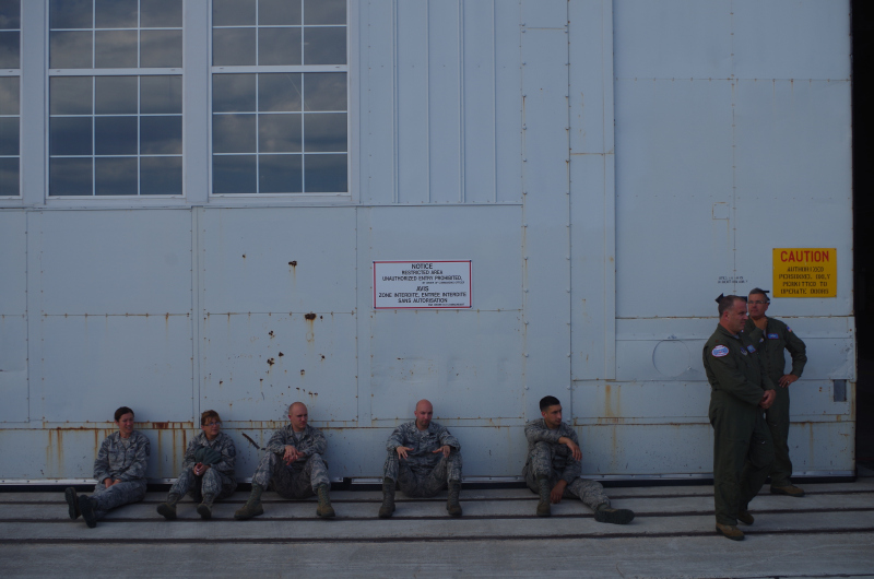
The stops in Goose Bay and Kanger reveal the close ties and continued influence that the U.S. has in both Canada and Greenland. Although the U.S. Air Force Base in Kanger closed in 1992, it still operates a small detachment in town, along with a golf course on the sandy glacial outwash plains and bar with cheap alcohol (hard to come by in Greenland). Flying from Labrador to Greenland also gives a sense of the proximity of these places within the North Atlantic. The Norse explorer Leif Erikson sailed from Norway to Greenland in 999 and may have even made it as far as Labrador.
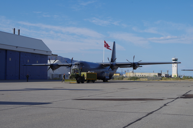
The U.S. isn’t the only game in town, however. A few days after we arrived, Denmark began carrying out military exercises in Kanger. The Danish influence is extremely strong in Greenland still – for instance, almost all products on the grocery store shelves are made in Denmark, while a local 5K/half marathon race last weekend was fundraising to send the town’s schoolchildren on their annual trip to Copenhagen. The reigning power demonstrated its military might with flights over the Arctic country within their kingdom. The red and white flag of the Scandinavian country was raised above the airport, and the Royal Danish Air Force’s C-130s (the same ones the U.S. uses, manufactured by Lockheed Martin, except painted in gray) sat on the runway. Earlier in the month, the RDAF also carried out F-16 missions over Greenland, and last year, Denmark announced it would build an Arctic-class naval vessel. As the U.S. has scaled back its military presence in Greenland (and in the greater North Atlantic, with the Naval Air Station in Keflavik, Iceland closing in 2006) over the past couple of decades, Denmark is scaling up.
In sum, the need for military flights to transport American scientists to Greenland (and Antarctica) demonstrates the deeply intertwined nature of the military and science in the U.S., especially when it’s science being done in extreme conditions like the poles. As Captain Rachel Leimbach, the supervisor of a flying rotation to Greenland earlier this year, stated about the 109th AW’s work in Greenland, “Our primary mission is in support of the National Science Foundation and CPS (CH2M Hill Polar Services). We fly missions to (forward-deployed locations) for the enhancement of science – similar to what we do in Antarctica.” The U.S. military wouldn’t have the capability to reach the poles were it not for advances in science and exploration, while scientists wouldn’t be able to get here without the big budgets, big planes, and big reach of the U.S. military. My British colleagues working here, for instance, have to fly commercially, as the Royal British Air Force does not have operations in Greenland. In contrast, the multiple U.S. science stations in Greenland are a direct outgrowth of the country’s longstanding military footprint on the island. Not too far from Kanger is Raven camp – a field site which only exists thanks to the presence of a ski-way training facility for the 109th Air Wing. And just up the road from Kanger is the Sondrestrom Incoherent Scattar Radar (ISR), a scientific research facility operated by the U.S. National Science Foundation. ISR is eerily reminiscent of the Distant Early Warning (DEW) Line radar stations built by the U.S. and Canada across the North American Arctic and Greenland during the Cold War. In Greenland – and the Arctic as a whole – science and the military are close bedfellows.
This post first appeared on Cryopolitics, an Arctic News and Analysis blog.

