Hot, dry conditions hamper efforts to fight some N.W.T. wildfires
Evacuation notice, not an order, issued on Monday for community of Whatı̀
Hot, dry temperatures and unusual late-season lightning storms in the Northwest Territories have been creating challenges for crews battling wildfires in the territory, according to wildfire information officer Mike Westwick.
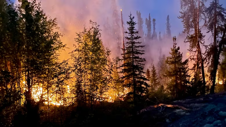
That’s particularly true for crews battling the fire labelled ZF048, which is burning about 15 kilometres from the community of Whatı̀, Westwick told CBC’s Trailbreaker Monday morning.
“It’s proven to be a very challenging fire in terms of suppression,” Westwick said.
“The fuels there are just so drought-ridden and dried out that it’s been giving us real problems.”
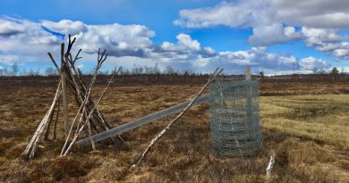
The community government of Whatı̀ issued an evacuation notice on Monday for residents, advising them to prepare for a potential evacuation of the community and to monitor news sources for updates. The notice is not an order to evacuate.̀
The fire near grew significantly in the 36-hour period between Saturday morning and Sunday night, driven by strong southerly winds, Westwick said.
Crews have been using air tankers to battle the blaze.
Parts of the N.W.T. have seen unseasonably warm temperatures since mid-August, according to Christy Climenhaga, a scientist with Environment and Climate Change Canada.
Sunday’s daytime high reached nearly 26 C, she said.
Rainfall far below average
That’s compared to an average Aug. 24 temperature of around 16 C, according to the weather office’s website.
There have also been more lightning storms, and the amount of rainfall has been far below seasonal averages, Climenhaga said.
“For the Yellowknife area, you’ve had 12.3 millimetres of precipitation so far in August,” Climenhaga said.
“Your normal precipitation for August is 44 millimetres.”
Inuvik, she added, has had just 7.1 mm of precipitation in August compared to an average of 42.4; Fort Simpson has seen just 7.5 mm compared with an average of 59.5 and Fort Liard has had 28.2 mm compared with an average of 54.4.
In addition to the above-average temperatures and well-below-average rainfall, N.W.T. has seen the most lightning in August since 2020 — more than 39,000 strokes — though the number includes both strokes that hit the ground and strokes between clouds, Climenhaga said.
The forecast for the coming week continues to call for unseasonably hot temperatures, she said.
But fire crews are hoping that easterly winds forecast for Monday will push fire ZF048 westward instead of northward toward Whatı̀, Westwick said.
Fighting that fire will be a priority for crews this week, he said.
So will protecting cabins from ZF015, which is burning near Highway 3 and creating smoky conditions for drivers.
Meanwhile, Weswtick called on people to do everything they can to avoid causing any more human-caused wildfires.
“We really need folks to treat this time as just as critical [a] period as we are from the fire service’s perspective,” he said. “Under the strong side winds that we’re expecting to see on days like Tuesday, those fires could become a real problem really quickly.”
With files from Hilary Bird
Related stories from around the North:
Canada: Why are so few people charged for causing wildfires in the N.W.T.?, CBC News
Finland: Wildfires continue to burn across Lapland, Yle News
Norway: Smoke from Canadian wildfires forecast to reach Norway, The Associated Press
Russia: New NOAA report finds vast Siberian wildfires linked to Arctic warming, The Associated Press
Sweden: High risk of wildfires in many parts of Sweden, including North, Radio Sweden
United States: Wildfires in Anchorage? Climate change sparks disaster fears, The Associated Press