What ancient earthquakes along the Denali fault in Yukon can tell us about what could come in Canada
New findings of earthquake recurrence on the Denali Fault line in southwest Yukon are helping researchers get closer to pinpointing when the next big one in the area might be.
Large earthquakes with a magnitude of 6 or higher — the kind that could shake homes or trigger landslides — happen along the Denali Fault once every 1,300 years or so, according to a study published in May in the Environmental and Engineering Geoscience Journal.
And the last large one? The study’s authors estimate it happened sometime between 1,200 and 300 years ago.
Though it’s a wide window, Andrée Blais-Stevens, a co-author of the study, said the information is critical to predicting potential future hazards.
“It’s important to know that there’s the potential for more,” Blais-Stevens said, adding when it does come, it could be a medium-to-large earthquake.
One of a few known seismically active terrestrial faults in Canada
The fault sits partially in Yukon and partially in Alaska, which has been more active with earthquakes over the years than the Canadian side. It’s located at the eastern front of the St. Elias Mountains and is one of only a few known seismically active terrestrial faults in Canada, the study says.
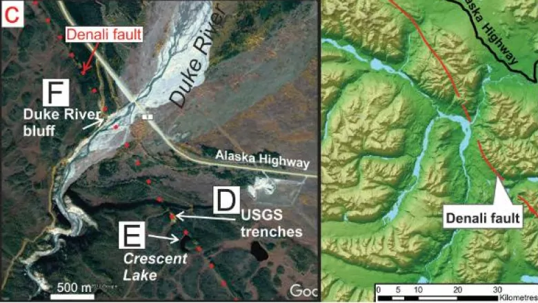
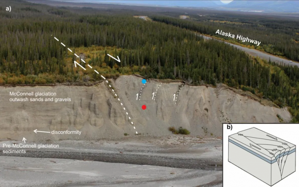
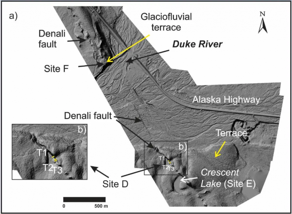
In their study, the researchers combined three studied sites to look into the geological past. This included analyzing the sediments of a dug-in trench that sits along the fault, and studying the sediment on the Duke River bluff and in Crescent Lake, which may once have been a bog that turned into a lake after an earthquake many years ago.
What the researchers found in the sediment helped them find possible disturbances caused by previous earthquakes and the approximate time period they happened.
Pacific Ring of Fire
The Denali Fault is part of the Pacific Ring of Fire. That’s where an oceanic plate moves underneath the continental plate and can cause earthquakes with subsequent tsunamis, and form volcanoes, Blais-Stevens said.
The Denali Fault is also known as a “strike slip” fault: where two pieces of continent rub against each other as they head in opposite directions.
This can either cause a downward compression, known as a negative flower structure, or in the case of the Denali Fault, an upward compression, known as a positive flower structure.
The mound formed by this compression — or the fault trace — is actually visible on Google Earth, Blais-Stevens said.
Research could help infrastructure plannning
Though the Denali Fault is less active than the notorious San Andreas Fault in California, it is comparable in form, she added.
The findings of the new research might help future infrastructure planning, too, Blais-Stevens said.
For example, she said, building codes based on whether a given area is seismically active or not could be created for infrastructure built close to the fault line.
Blais-Stevens said thawing permafrost, which already triggers landslides, would likely be exacerbated by ground shaking.
Several active faults in Yukon
Yukon is no stranger to earthquakes, with several other active faults in the territory.
In 2017, a magnitude 6.2 earthquake hit parts of Yukon, northern B.C. and Alaska early in the morning, causing power outages, damaging buildings and shaking people awake. It was followed by a 6.3-magnitude earthquake just a few hours later.amy
Blais-Stevens said, there aren’t that many active faults that are well documented on land in Canada. She said the new research is an example of going back in time in the geological record to identify seismic activity, which can contribute to identifying the recurrence pattern.
“Why it matters is we try to provide the baseline geoscience information to the ones that make decisions,” Blais-Stevens said.
“If we can help demonstrate a recurrence, then decisions will hopefully be made to help keep Canadians safe from seismic hazards in Yukon.”