No tsunami threat to B.C. after powerful M8.2 earthquake shakes Alaska
Quake that struck on Wednesday night was the most powerful recorded in U.S. or Canada since 1965: USGS data
A powerful earthquake that struck just off Alaska’s southern coast caused prolonged shaking and prompted tsunami warnings that sent people scrambling for shelters.
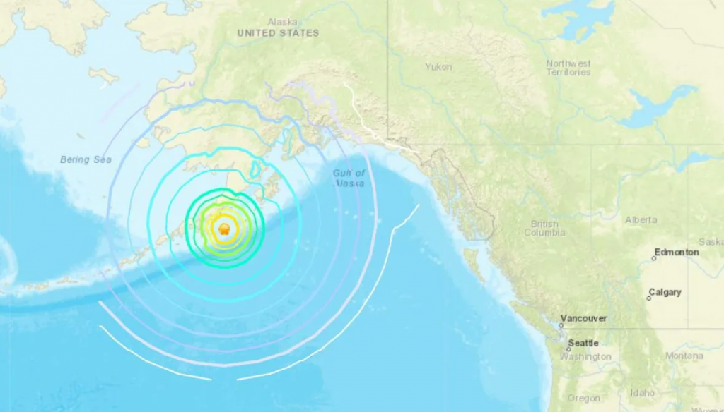
The U.S. Geological Survey (USGS) said the quake measured magnitude 8.2 and hit 91 kilometres east southeast of Perryville, Alaska, at about 8:15 p.m. PT Wednesday. It struck about 46 kilometres below the surface of the ocean, according to USGS.
It was one of the most powerful quakes in U.S. and Canadian recorded history, and the largest since 1965, according to USGS data.
Residents reported only minor damage, but officials said that could change after sunrise and people get a better look.
People living in coastal areas of British Columbia waited anxiously past midnight as emergency officials evaluated the local tsunami risk. After more than three hours, officials confirmed there was no threat to the province just after 2:30 a.m. PT.
Roughly 800 people from Kitamaat Village, south of Kitimat, B.C., moved to higher ground as a precaution.
“My daughter woke us up and said that our emergency crew was going around the streets telling everybody to get to higher ground. So in a stupor, I helped get my family out the door,” Skeena MLA Ellis Ross told CBC’s Daybreak North on Thursday.
“My adrenalin was pumping so hard. I was on top of the hill directing traffic, trying to keep people moving, keep people calm,” added Ross, who helped develop the community’s emergency plan as chief councillor of the Haisla Nation.
“It was not much time to think about anything, really, except getting people to a certain place safely.”
The National Tsunami Warning Center cancelled warnings early Thursday when the biggest wave, of just over a half foot, was recorded in Old Harbor, Alaska. A tsunami warning that had been issued for Hawaii was also cancelled, and officials said there was no threat to Guam, American Samoa or the Commonwealth of Northern Mariana Islands.
The warning for Alaska covered nearly a 1,600-kilometre stretch from Prince William Sound to Samalga Island, near the end of the Aleutian Islands.
‘We’re used to this’
Patrick Mayer, the superintendent of schools for the Aleutians East Borough, was sitting in his kitchen in the community of Sand Point when shaking from the quake started.
“It started to go and just didn’t stop,” Mayer told the Anchorage Daily News. “It went on for a long time and there were several aftershocks, too. The pantry is empty all over the floor, the fridge is empty all over the floor.”
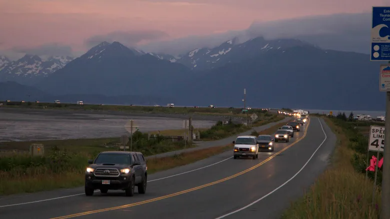
On the Kenai Peninsula, a steady stream of cars were seen evacuating the Homer Spit, a jut of land extending nearly eight kilometres into Kachemak Bay that is a draw for tourists and fishermen.
In King Cove, up to 400 people took shelter in the school gym.
”We’re used to this. This is pretty normal for this area to get these kind of quakes, and when the tsunami sirens go off, it’s just something we do,” school principal Paul Barker told the Anchorage newspaper.
“It’s not something you ever get used to, but it’s part of the job living here and being part of the community.”
Several other earthquakes, some with with preliminary magnitudes of 6.2 and 5.6, occurred in the same area within hours of the first one, USGS reported.
-With files from Rhianna Schmunk
Related stories from around the North:
Canada: What ancient earthquakes along the Denali fault in Yukon can tell us about what could come in Canada, CBC News
United States: Powerful 7.8 earthquake hits Alaska isles; tsunami threat over, The Associated Press
