Alaska glaciers losing 46 billion tons of ice each year

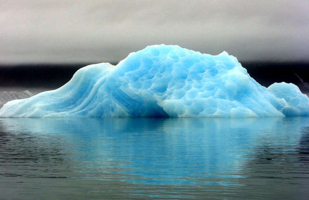
Alaska glaciers have been shedding about 46 billion tons of ice each year, making America’s Arctic state the world’s single biggest contributor to glacier-fed sea level rise outside of Greenland or Antarctica, say new estimates published this week in the online edition of the journal of Nature.
Still, Alaska remains a wee player in the global ice frappe, producing only about 8.5 percent of the world’s annual glacier shrinkage of 526 billion tons, according to the study, led by a team at the University of Colorado at Boulder.
The total mass ice loss from Greenland, Antarctica combined with all of Earth’s other glaciers and ice caps amounted to about 1,000 cubic miles — about eight times the water volume of Lake Erie, explained UC-Boulder physicist John Wahr in this story about the work.
“The total amount of ice lost to Earth’s oceans from 2003 to 2010 would cover the entire United States in about 1 and one-half feet of water,” added Wahr, a fellow at the CU-headquartered Cooperative Institute for Research in Environmental Sciences.
Most of Alaska’s annual ice loss occurs in the snow-bound coastal ranges that crown the Gulf of Alaska, and it’s a huge chunk — contributing about one third of the 150 billion tons of total annual ice loss from 18 regions around the globe outside of the two much larger continental sources.
Southern Alaskans take note: we are seasonal witnesses to this process. The inexorable retreat of Portage Glacier from view at Portage Lake, and other shrinkage by ice tongues in Anchorage’s Chugach State Park, have all made tiny-but measurable-additions to this overall glacier breakdown.
Only shrinkage by the glaciers on Baffin Island (about 35 billion tons) and the Ellesmere Island area (about 34 billion tons) rival the Alaskan retreat, the study reported.
Still, size matters. The loss of ice from Alaska and the Canadian Arctic remains small when compared to the losses seen in the ice sheets of Greenland and Antarctica. Between 2003 and 2010, the continental ice sheets on Greenland dumped 222 billion tons annually, while Antarctica lost 165 billion tons.
Measuring gravity with eyes in the skies
To get the totals, the researchers basically resorted to rocket science, using data gathered by the tandem satellites of the Gravity Recovery and Climate Experiment, or GRACE, a joint effort of NASA and Germany.
Launched in 2002, the GRACE satellites zip around Earth 16 times each day in a 300-mile-high orbit, traveling about 135 miles apart. They dial in tiny changes in the Earth’s gravitational pull and keep track of any shifts in the planet’s mass caused by melting ice. These ultra-precise measurements have been producing gravity maps about 1,000 times more accurate than previous efforts. For more detail, here is a primer on how GRACE works and the latest fix on its orbit around the globe.
The current study used the satellites to estimate the “mass balance” of the world’s glaciers — the difference between the melt of summer and the growth from snow accumulation during winter. Finding a glacier’s mass balance is critical to gauging its health — whether it’s growing or shriveling up — but can take weeks or months of dangerous, expensive field work spread over many seasons. Only a small fraction of the world’s glaciers have been studied on the ground.
“This is the first time anyone has looked at all of the mass loss from all of Earth’s glaciers and ice caps with GRACE,” Wahr explained here. “The Earth is losing an incredible amount of ice to the oceans annually, and these new results will help us answer important questions in terms of both sea rise and how the planet’s cold regions are responding to global change.”
The United Nations Climate Panel has published estimates that sea global sea level will ultimately rise between 7 inches and almost two feet by 2090, the Christian Science Monitor reported in a story about the study. “But those numbers do not include melting from polar regions where the vast majority of the world’s freshwater is locked away.”
Melt all of the Greenland and West Antarctic ice sheets, and ocean levels might rise as much as 200 feet. Using GRACE gave scientists a method to find out what had really happened over the past decade and zero in on hard-to-study glaciers and refine all of the estimates for sea level rise, Wahr said.
Too many glaciers, too little time, too much ice-cold melt
“There are simply too many glaciers, and most of them too remote to access, to be able to monitor all of them from the ground. There are more than 200,000 glaciers world-wide,” he told the Monitor here. “With GRACE, though, we’re able to directly monitor the sum total of all ice loss in an entire glacier system or ice cap.”
For instance, scientists had incomplete data for many inaccessible glaciers in Asian mountains, particularly those scattered throughout the Himalayas. The eye-in-the-sky accuracy of GRACE cut the amount of estimated ice loss from Asian glaciers to about 4 billion tons per year, about 10 times less than some previous estimates. This new insight dominated much of the extensive online coverage of the study.
“The GRACE results in (the Asian region) really were a surprise,” Wahr commented here. “One possible explanation is that previous estimates were based on measurements taken primarily from some of the lower, more accessible glaciers in Asia and were extrapolated to infer the behavior of higher glaciers. But unlike the lower glaciers, many of the high glaciers would still be too cold to lose mass even in the presence of atmospheric warming.”
The bottom line? Sea level rise caused by all of the planet’s land-based ice melt (not counting the expansion of water due to warming) was about 1.5 millimeters per year annually from 2003 to 2010, according to the study. That’s about 12 millimeters, or one-half inch over eight years, from glacial wastage alone.
Throw in the thermal expansion of water as it grows warmer, and the total estimated rise in sea level over that period was more than double.
“One big question is how sea level rise is going to change in this century,” added co-author Tad Pfeffer, a CU-Boulder professor who has done extensive work measuring the mass balance of Alaska glaciers, in this story.
“If we could understand the physics more completely and perfect numerical models to simulate all of the processes controlling sea level — especially glacier and ice sheet changes — we would have a much better means to make predictions. But we are not quite there yet.”
Contact Doug O’Harra at doug(at)alaskadispatch.com
For more stories from Alaska Dispatch, click here.


