Record-breaking temperatures hit southern N.W.T.

Temperatures in the southwest of territory are between eight and 20 degrees above normal
As the last of the risk of flooding flows away, Hay River residents may have another issue to deal with — record-breaking temperatures.
This is Hay River’s warmest May 3 on record.
Temperatures in the community reached 30 C, three degrees warmer than the previous record high for the day.
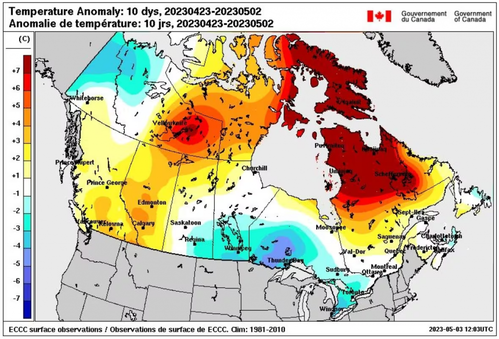
Overall, the southwestern N.W.T. is experiencing an abnormally warm spring.
“We’re talking, eight to up to 20 degrees above normal,” said Jesse Wagar, a meteorologist with Environment and Climate Change Canada.
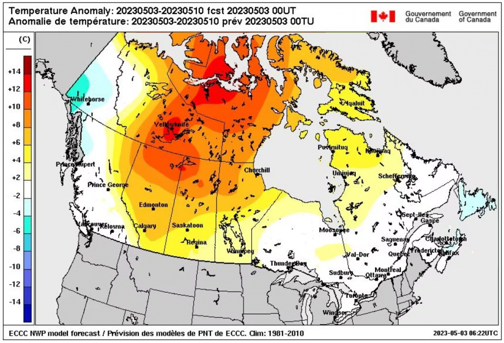
A low pressure system will lower temperatures on Thursday, but Wagar expects them to “rebound” and stay in the high teens and low 20s for the next week or so.
“This strong upper flow pattern that’s bringing in these warm temperatures … it’s been pretty stagnant and it’s gonna take a lot to push this thing out of the way,” she said.
Beyond that, Wagar says this is an El Niño year, meaning a warmer-than-normal summer.
The previous record-high in Hay River was registered in 2016.
Effects on possible flooding
The warm temperatures are softening river ice as spring break-up proceeds, according to the latest N.W.T. government’s water monitoring bulletin.
While it says the Liard and Mackenzie Rivers are rising under the ice near Fort Simpson, the water level increases are small.
“Satellite imagery indicates that the snowpack has melted in almost all the lower Liard River basin and that snowmelt runoff delivery has likely ceased,” reads the Wednesday bulletin.
It also says there are patches of open water between Jean Marie River and Fort Simpson.
Concerns will soon turn toward the risk of wildfires.
The territorial government will hold a briefing on wildfires for the press on Thursday afternoon.
-With files from Lawrence Nayally
Related stories from around the North:
Canada: “Our climate is changing before our eyes,” says WMO upon release of new report, Eye on the Arctic
Finland: Finland sees “exceptionally” mild January, Yle News
Greenland: Greenland’s temperatures warmest in last 1000 years, says study, Eye on the Arctic
Norway: Will the green transition be the new economic motor in the Arctic?, Eye on the Arctic
Sweden: Sweden’s climate policies closer to reaching goals, Radio Sweden
United States: Bering Sea ice at lowest extent in at least 5,500 years, study says, Alaska Public Media