Study underway to better understand landslides in northern Quebec
A study is currently underway to gain a better understanding of landslides in northern Quebec, following four significant incidents within the last four years.
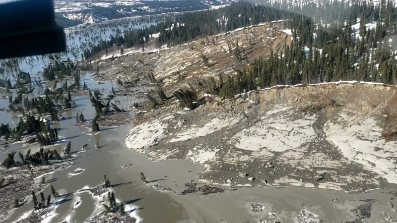
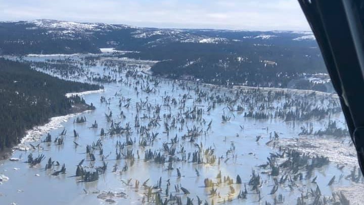
In one event, a 2021 landslide sent over 45 million cubic meters of debris into Great Whale River. At the time, it was deemed the second-largest landslide in Quebec’s recorded history.
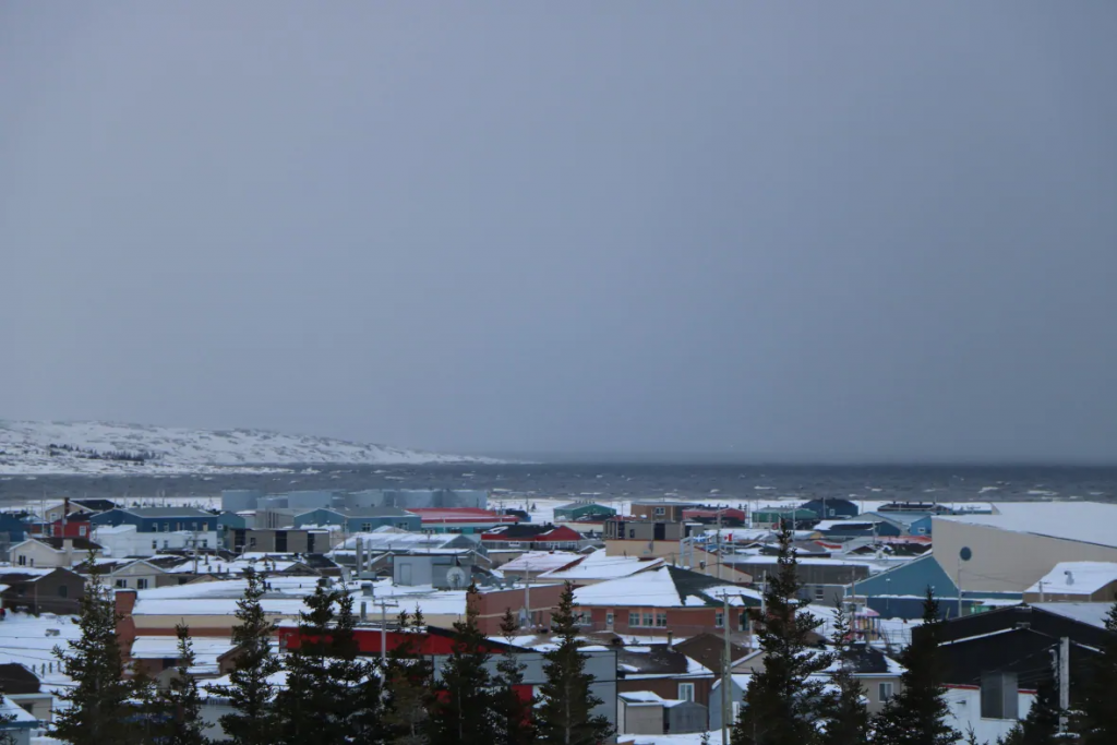
Although there was no immediate threat to residents in the nearby communities of Kuujjuarapik and Whapmagoostui, the sheer scale of debris in the river raised concerns about long-term impacts on the waterway’s flow, and the impact future incidents could have on traditional hunting trails and harvesting lands.
“[Locals] say they’re hesitant to navigate certain areas of the river because of debris left from the landslides,”Ariane Locat, a professor in the Faculty of Science and Engineering and coordinator of the Natural Risk Studies Laboratory (LERN) at Université Laval in Quebec.
“Some trees are still shifting, and the area is risky to travel through.”
Government wants data to better respond to emergencies
Quebec’s Ministry of Public Security is also working with the researchers from Université Laval to study the clay soils in the region and figure out why landslides are becoming more common.
The government has put $858,000 into the project as part of Quebec’s Disaster Prevention Program. The Ministry of Transportation and Sustainable Mobility is also involved, with the goal of better understanding the soil to improve mapping and plan for future emergencies.
“When government engineers need to respond to emergencies, they face a lack of documentation on the area’s soil,” Locat said.
“Any additional knowledge gained from our project will be beneficial for them, especially for mapping the region.”
Field Research in Remote Areas
To collect data for the project, the research team is using helicopters to reach remote locations and gather soil samples for analysis. Their goal is to understand what triggered the recent landslides and if there’s a connection to climate change, given that northern regions are warming faster than those in the south.
Early findings indicate that the soils in the Hudson Bay area might be more susceptible to disturbances like earthquakes and erosion, which can lead to landslides.
“Landslides like this happen in southern regions, but they’re much larger in scale up here,” said Locat. “It’s intriguing and we want to understand why.”
Some of the research will also extend to the James Bay area, where roads make it easier to travel and access sites with drilling equipment.
Findings from James Bay will help researchers make connections with the similar geological conditions in Hudson Bay, the study team said.
Comments, tips or story ideas? Contact Eilís at eilis.quinn(at)cbc.ca
Related stories from around the North:
Canada: Spring melt in Whitehorse could bring more landslides, geologist says, CBC News
United States: Alaska governor declares disaster after landslide kills 1, hospitalizes 3 others, CBC News