Nunavut community to take part in seafloor mapping initiative
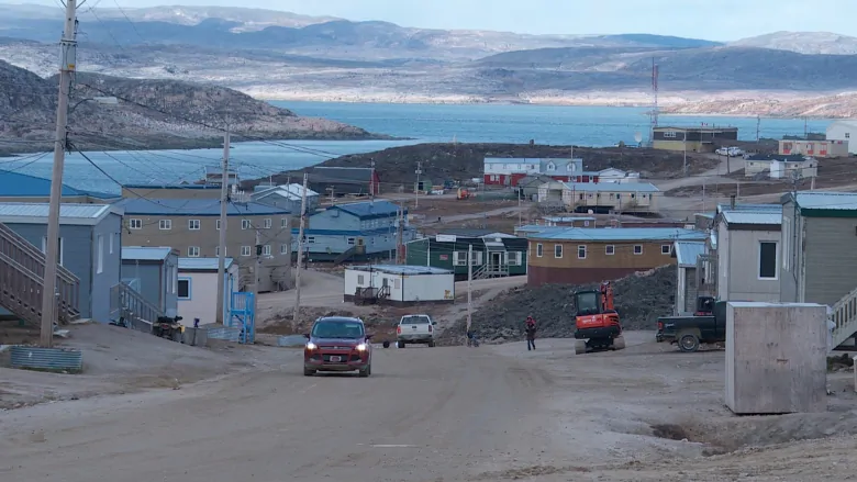
The Nunavut community of Kinngait is taking part in a new program to better understand Canada’s waters, by having its harvesters chart the areas where they hunt and travel.
“We recognize that there’s a lot of communities that this type of data is important to,” Mark LeBlanc, from the Canadian Hydrographic Service, told Eye on the Arctic in a phone interview.
“Having the ability to empower the community to do the collection, make sure it responds to specific local need, and that the communities are doing their own science, is really important.”
The initiative, called the Community Hydrography program, is a federal government program.
Hydrography is the science that measures and describes the physical features of bodies of water, and the project was for communities to get the equipment and training needed to chart the areas around them.
Communities or organizations can submit proposals to the Community Hydrography program to be considered.
The first proposals accepted were announced on Wednesday and went to the Qikiqtaaluk Corporation, the body that works on business and economic development in Qikiqtani, the region of Nunavut where Kinngait is located, and the Mi’kmaq Alsumk Mowimsikik Koqoey Association in the province of Newfoundland and Labrador.
No one at the Qikiqtaaluk Corporation could be reached for comment this week, but in a statement, its vice-president of fisheries said they hope the project can be made more widely available.
“Our hope is to extend this program to additional communities in our region in the coming years.”
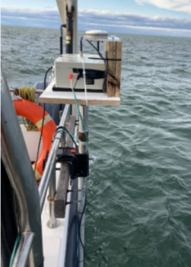
Harvesters and community members travelling by boat in Kinngait will be provided with data loggers for their vessels along with training on how to use them. Afterwards, the data can be used for everything from identifying sensitive areas, locating good areas for fishing, or identifying marine hazards.
The community will remain owners of the data.
“We’re more than happy to receive and review the data and assist in creating products from there with the community, but it’s really the community’s decision what they want to do,” LeBlanc said.
Community and scientific cooperation in the North
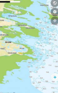
At 243,042 km, Canada has the longest coastline in the world, making community and scientific cooperation key especially in the North, LeBlanc said.
“We have a general map of the oceans of Canada, but to get at a scale of detail for making meaningful decisions in a community, you need a higher resolution of data and cover 100 per cent of the area” he said.
“To be at 100 per cent of modern data, we’d have to cover 100 per cent of all the waters of Canada, which for the department, and the Canadian Hydrographic Service, is just not within the realms of possibility with the current technology.”
But having communities do the work in their areas, means they can gather data according to their current, everyday needs, LeBlanc said.
“By empowering communities to do the collection, they can go ahead and get some really good data right away and then make their decisions, rather than waiting several years for us to schedule a survey in the area,” he said.
“That’s why these partnerships are so important. Traditional knowledge has ensured good stewardship of the oceans and sensitive areas for thousands of years and making these these connections and collaborations, we’ll learn how to do our science better.”
The Community Hydrography program runs until 2027.
Comments, tips or story ideas? Contact Eilís at eilis.quinn(at)cbc.ca
Related stories from around the North:
Canada: Tourism of uncharted Arctic waters ‘dangerous’, says Canadian professor, CBC News
Greenland: Climate change accelerating ice loss from peripheral glaciers, Eye on the Arctic
Denmark/Greenland: New guideline launched for Arctic-specific risk assessment in shipping, Eye on the Arctic
United States: Bering Sea ice at lowest extent in at least 5,500 years, study says, Alaska Public Media