New research reveals vulnerability of Arctic water networks to global warming

An international team, including experts from Canadian universities, has published new research shedding light on the vulnerability of Arctic water networks to global warming, and the potentially far-reaching impacts on things like erosion.
“Our research highlights and provides another data point of how the planet is responding to the warming climate that we’re in,” Shawn Chartrand, an assistant professor in the School of Environmental Science at Simon Fraser University, and the paper’s lead author, told Eye on the Arctic in a phone interview.
“We know that air temperatures in the High Arctic are warming at a faster rate than the rest of the planet. Raising general awareness about how these changes affect specific geographic areas can benefit everyone.”
The impact of polygons
One of the researchers’ important findings was how waterways were affected by polygons in the Arctic and how floodwaters flowing through the troughs of these formations can result in more erosion and the creation of river channels.
“There are many tools available to explore how landscapes may respond to warming climates and changes in the amount of water supplied as well as sediment supplied,” Chartrand said. “But we can’t use those tools until we better understand the basic physics of how these systems work in terms of erosion of the riverbed.”
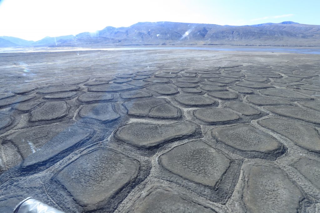
- Polygons are formed on the Arctic during the freeze, thaw cycle.
- They refer to the subsurface ice wedges that form when the ground thaws, and melted water at the top seeps into cracks.
- The frozen earth then freezes that water creating the wedges.
- Because the wedges occur at low spots, water naturally congreates there
- Each year, additional water is added, meaning the wedges get bigger. The ice also expands, enlarging the space.
Research for the paper was conducted on Axel Heiberg Island, an unpopulated landmass located in Canada’s Arctic Archipelago.
There, the international team gathered field observations and data from one of the island’s valleys, and compared them to air photographs of the region from 1959.
‘Rapid time of development’
They then modeled a 400-metre portion of the valley to better understand how water flow across the terrain had changed over six decades.
“It appears many polygons in the valley formed just within that intervening 60 years,” Chartrand said. “That’s quite a rapid time of development relative to some theories that exist in the science literature, so that caught our attention immediately.”
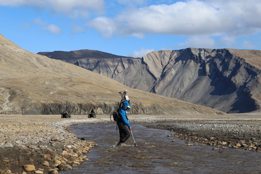
Chartrand said the other aspect that caught the researchers’ attention was the way the polygons controlled how water moved down the lowest point of the valley’s floor during seasonal flooding events.
“Polygon control of surface water routing through the valley floor has been hinted at before in the literature, but through the modeling we report in the paper, I think we pretty demonstrably show that it can have a strong control on how water moves through the landscape,” he said.
“And as a result, they can have a strong control on how rivers and channels evolve and develop over time as more water is moved across the landscape seasonally.”
Chartrand says the research can now be used as a springboard to better understanding, and predicting, the development, and behaviour of Arctic waterways, as the North experiences warmer weather and more extreme climate events.

Comments, tips or story ideas? Contact Eilís at eilis.quinn(at)cbc.ca
Related stories from around the North:
Canada: As Nunavik’s permafrost thaws, locals and researchers focus on adaptation, CBC News
Russia: Melting permafrost may release industrial pollutants at Arctic sites: study, Eye on the Arctic
United States: Ice decline in Bering Sea could affect carbon export and fish ranges, Eye on the Arctic

