Satellite walrus counts validated by drone, ground observations
A project examining the accuracy of public walrus population counts based on satellite imagery has validated these counts using drones and on-the-ground visual observations.
The findings were published this week in the journal Remote Sensing in Ecology and Conservation.
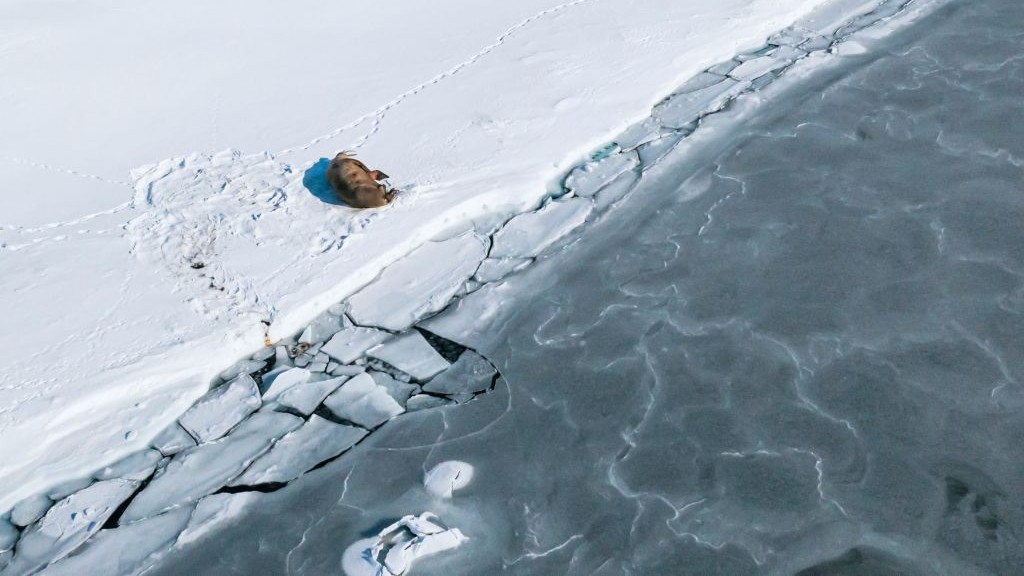
“We were able to get an on-the-ground drone image within minutes of a satellite image taken from space,” Hannah Cubaynes, a wildlife-from-space scientist at British Antarctic Survey (BAS) and the paper’s lead author, said in a statement.
“This was totally unprecedented and the best result we could have hoped for. This is a really exciting development for the project – giving us almost like-for-like satellite and drone images that we can use to calibrate walrus counts from both experts and citizen scientists.”
Public participation
The Walrus from Space project was launched in 2021 by the British Antarctic Survey (BAS) and the World Wildlife Fund (WWF).
The project encouraged the public to volunteer spotting and counting walruses through satellite imagery.
This initiative was seen as a way to conduct semi-real-time monitoring of walrus populations year-round and overcome the challenges of population monitoring in remote and difficult-to-access regions, where fieldwork is often hindered by harsh weather conditions.
It’s also non-invasive to the animals.
Urgent need to understand climate impacts on walrus
Part of the five-year project also involves scientists travelling to Svalbard by boat to different walrus haul-out areas so the animals can later be counted visually and by drones to gauge the accuracy of the satellite counts.
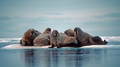
Walruses rely on sea ice for resting, giving birth, and accessing food. They use the ice as a platform to dive into the ocean and forage for food like starfish, molluscs, and sea cucumbers using their thick whiskers.
Because of walruses’ dependence on sea ice, researchers are particularly interested in how climate change—which is causing the sea ice to shrink—will affect the animals.
The reduction in sea ice also leads to increased shipping traffic in the Arctic, introducing new disturbances to the walruses. The combined effects of habitat change and increased human activity pose significant challenges to their survival.
“Walruses are an iconic species, of immense cultural significance to Arctic people,” Rod Downie, chief polar advisor at WWF-UK, said. “They are big, powerful animals, yet they are also increasingly vulnerable to the effects of climate change as the sea ice is literally melting out from underneath them.”
“What we are trying to do is better understand walruses, how they are responding to the climate crisis now and how they might respond in a climate-altered future. We are doing this to provide evidence to support the conservation of the species across its range.”
Satellite imagery ‘giant step forward’
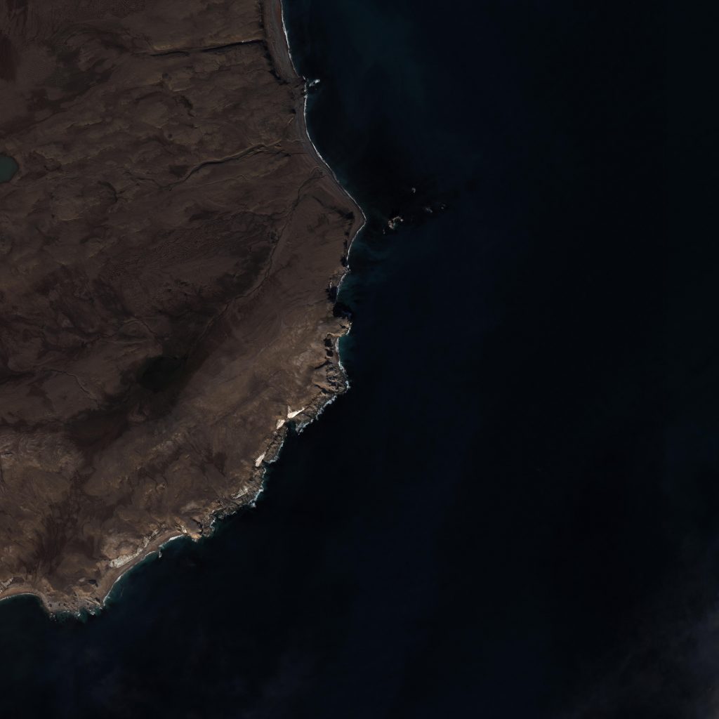
The satellite images used were in three spatial resolutions: 15cm, 30cm, and 50cm.
The counts from these images were then compared with those obtained by drones which were clearer and made the animals easier to identify.
The 30cm spatial resolution was found to be the most accurate of the satellite images.
Kit Kovacs and Christian Lydersen, senior research scientists at the Norwegian Polar Institute/Norsk Polarinstitutt, said the findings were an important tool to better understand the species amidst a changing Arctic.
“All Arctic endemic marine mammal species are being negatively impacted by global warming through losses in their sea ice habitats,” the researchers said.
“This increases the need to monitor populations more closely to provide data to management authorities for mitigation and conservation actions. However, these animals are spread over large areas and are thus logistically challenging and very costly to count using ships or aircraft. Being able to monitor walruses (and other Arctic wildlife) using satellite imagery would be a giant step forward.”
The report was released on May 22 to coincide with the International Day for Biological Diversity.
Comments, tips or story ideas? Contact Eilís at eilis.quinn(at)cbc.ca
Related stories from around the North:
Canada: Narwhals stable: Inuit partnerships crucial says COSEWIC, Eye on the Arctic
Finland: Possible record year for arctic fox in Nordics with 762 cubs counted in 2022, Eye on the Arctic
Sweden: Wildlife project to save endangered species in Sweden, Radio Sweden
Russia: Oral histories unlock impact of climate change on nomadic life in Arctic Russia, says study, Eye on the Arctic
United States: Alaska law officer killed in muskox attack outside his house, The Associated Press