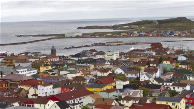
For decades a territorial dispute had simmered between Canada and France because of the tiny French islands of St Pierre and Miquelon which lie just south of Newfoundland
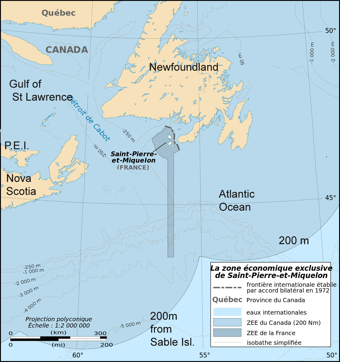
An international committee in 1992 largely rejected France’s claims to additional ocean territory, but granted a 10.5 km economic zone 200nm south. France appears ready to claim territory further out into the continental shelf which conflicts with Canada’s claims.
In the past, this had mostly been about control of ocean for fishing, but with the prospect of potential reserves of gas and oil beneath the ocean floor, the dispute is set to flare up once again.
With the recent rush by coastal countries to map their continental shelves into the ocean and extend territorial waters, France has stirred the issue by saying the tiny French archipelago has its rights to extend its ocean territory as well.
Following a meeting in France last summer with political representatives from St Pierre and Miquelon, French President Francois Hollande said “France will defend the interests of the archipelago concerning the extension of the continental shelf”
Recently he said that France will put its position to the the UN committee tasked with the continental shelves issue, by April of this year. Hollande says. “France wants to ensure its rights are recognized, and St Pierre and Miquelon, as French territories have rights to their continental shelf according to international rules.
He added, “We will go anywhere necessary to defend this position”
It should be noted that the territorial dispute was originally settled by an international committee in 1992. Neither side was pleased by the result, although France less so. Sometimes referred to as the “keyhole” or alternatively the “baguette”. in addition to a 12 nautical mile limit,the islands were granted a 200 mile strip ten and half miles wide, supposedly to give a corridor to the open Atlantic. However, it remains, as would any future 200nm claim by France, entirely within Canada’s own 200nm Economic Exclusion Zone (EEZ)
It can be expected that in any future dispute France’s previous arguments against granting additional area around Britian’s Channel Islands will be able to be used against it
In that case the French argued against giving the Channel Islands more territory to be within the British boundary saying that would give the small islands more importance than they deserved and such a claim was not supported by law or practice.
The Court of Arbitration at the time largely sided with France saying “…the Channel Islands are not only ‘on the wrong side’ of the mid-Channel median line but wholly detached geographically from the United Kingdom.
The Channel Islands boundaries are now consistent with the 12 nautical mile arcs and lie enclaved within the French side of the median line between France and England.


For reasons beyond our control, and for an undetermined period of time, our comment section is now closed. However, our social networks remain open to your contributions.