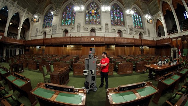
The corridors of Canadian political power welcomed a new visitor on Tuesday (April 9), a Google Maps Trolley documenting Canada’s Parliament in Otttawa.
The push cart that allows the 360-degree views includes motion sensors to track the position of the Trolley, a hard drive to store all the image data, and an onboard computer to operate it.
On Google Canada’s blog page, Aaron Brindle wrote: “Today, Canada’s capital opens its doors to Google Maps. From the floor of the House of Commons and the Red Chamber of the Senate, to the Library of Parliament and the Prime Minister’s Office, the Street View Trolley is making its way through the hallowed halls of Parliament, mapping this iconic landmark of Canadian history and culture for all Canadians to enjoy and explore.”
More information:
Google Canada Blog on Street View on Parliament Hill – here


For reasons beyond our control, and for an undetermined period of time, our comment section is now closed. However, our social networks remain open to your contributions.