A very interesting archeological and historical side has emerged from a a large military exercise in Canada’s far north called Operation Operation Nunalavilut 2014.
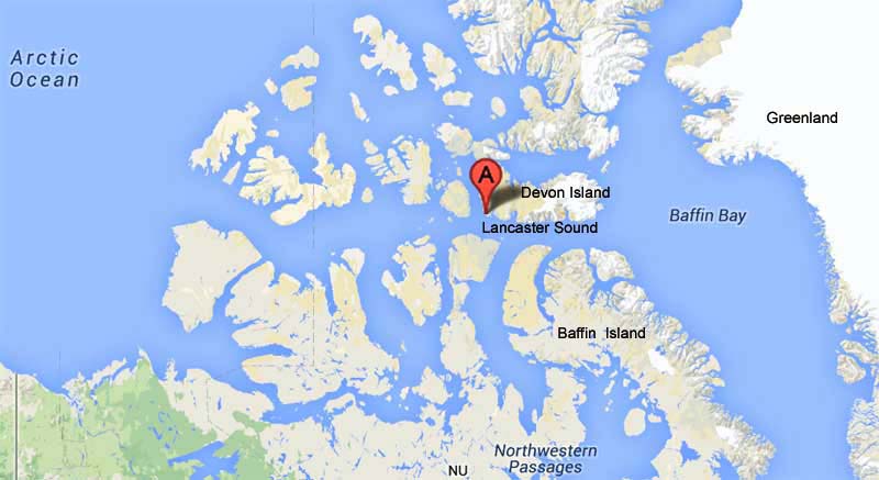
Beechey Island is a tiny Island off the south-west coast of Devon Island in the high Arctic of Canada (Click to Enlarge)
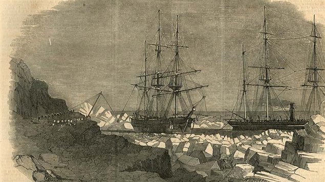
In 1853, the three-masted HMS Breadalbane, involved in the search for Captain John Franklin’s lost expedition, itself became stuck in the Barrow Strait near Beechey Island, Nunavut. The hull was later pierced by the ice and the ship sank rapidly, although the crew was able to scamper to safety and picked up by another Royal Navy ship.
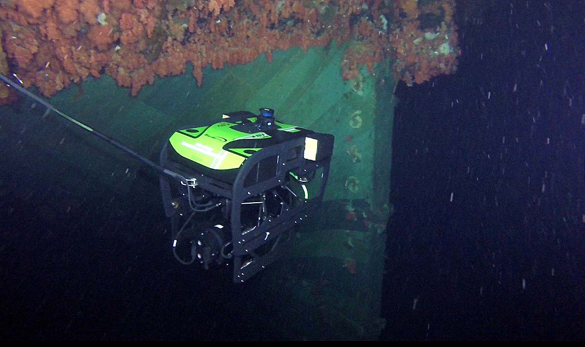
A remote operated vehicle (ROV) operated by Clearance Divers from Fleet Diving Unit (Atlantic) takes a video of the Breadalbane’s stern. (CLiCK to ENLARGE)
The wreck was discovered some 127 years later resting on her keel, but lying at 100 metres and in such a remote location, it remained difficult to explore.
With the assistance of Parks Canada’s Underwater Archaeology Service and SeaBotix Inc., clearance divers from the Royal Canadian Navy Fleet Diving Unit (Atlantic) used multiple remotely operated vehicles to capture HD footage of the wreck.
Although there have at least two previous remote sub and manned sub visits and filming of the wreck, the expertise and technology used by the dive team this year will provide archaeologists with a wealth of new data that will enable them to gain a better understanding of the ship, which was declared a national historic site in 1983
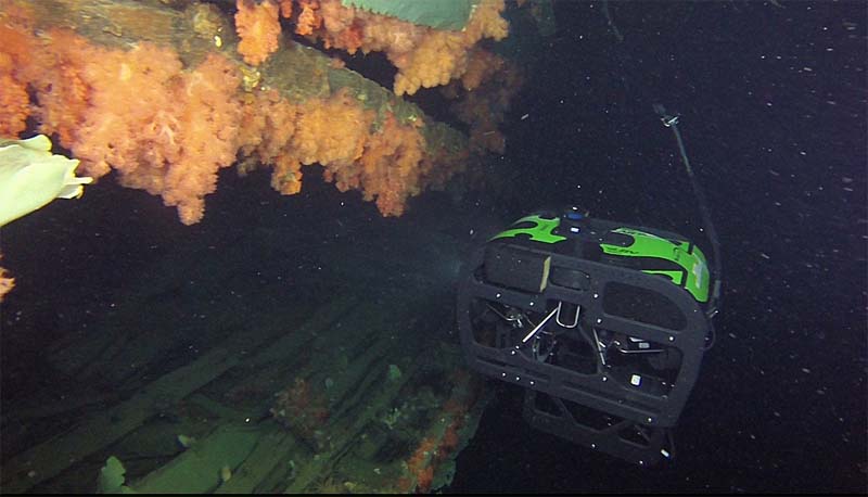
remote vehicle viewing damage to starboard side (photo Joint Task Force (North) (CLICK to ENGLARGE)
The entire archive of the footage and date gathered by the Canadian Forces and associates will be shared and preserved by the Government of Nunavut and Parks Canada.
Jonathan Moore is the senior underwater Archaeologist with Parks Canada, and was involved in the discovery of HMS Investigator, another ship which became trapped in ice, and eventually sank while seeking Sir John Franklin’s lost expedition.
“Six days of diving with remotely operated vehicles this year have given us an up-to-date view of an incredible wreck that preserves a moment of time in Canadian history. We’ve learned a huge amount about the wreck during this project, and it’s rare to have such a detailed view of a shipwreck from 1853. We anticipate more discoveries and insights as we pore over the collected information”, said Mr Moore.
Operation NUNALIVUT is an annual premier High Arctic operation that is conducted by Joint Task Force (North), combining Air, Land and Maritime operations to exercise interoperability and skill-sets in the challenging Arctic environment.


For reasons beyond our control, and for an undetermined period of time, our comment section is now closed. However, our social networks remain open to your contributions.