Floodwaters have surged past record levels in parts of New Brunswick, fed by a double whammy combination of rains and rapid snowmelt due to unseasonably hot weather, forcing authorities to close down the main highway connecting the province to Quebec and Nova Scotia.
The province’s Emergency Measures Organization (EMO) reported Thursday that the city of Saint John has hit water levels not seen since 1973 and will likely exceed that on Saturday, while the town of Jemseg has surpassed historic records.
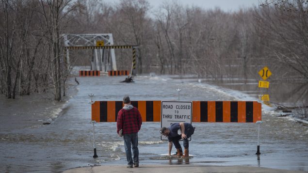
Trans Canada Highway closed
Local residents head to check on their house surrounded by the waters of the St. John River in Fredericton, N.B. on Sunday, April 29, 2018. (Andrew Vaughan/THE CANADIAN PRESS)
The Department of Transportation and Infrastructure warned residents that Route 2, also known as Trans Canada Highway, between Moncton and Fredericton will be closed to all traffic Thursday evening as water levels continue to rise.
The closure, which will occur at approximately 7 p.m. ADT, will affect both the eastbound and westbound lanes, authorities said.
Those travelling between Moncton and Fredericton will be detoured to Route 1 through River Glade and Route 7 at Oromocto.
Those who need to travel between Moncton and Fredericton are urged to do so before the anticipated closure, authorities said.
Smashing records
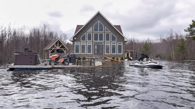
Mike Roy uses a personal watercraft to pull a dock loaded with a hot tub and lawnmower as floodwaters surround his home on Grand Lake, N.B. on Tuesday, May 1, 2018. (Darren Calabrese/THE CANADIAN PRESS)
EMO spokesman Geoffrey Downey said emergency officials continue to urge anyone in communities of the St. John River basin such as Grand Lake, Jemseg, Gagetown, Hampstead, Belleisle, Oak Point, Grand Bay-Westfield, Quispamsis and Saint John to be on high alert and be ready to evacuate their homes at a moment’s notice.
“In the area south of Fredericton records are being smashed unfortunately,” Downey said in a phone interview with Radio Canada International.
During high tide at 2:30 a.m., the city of Saint John reached its 1973 flood level of 5.4 metres and the water is still rising, Downey said.
The city of Saint John issued a voluntary evacuation notice Tuesday evening for residents near Westfield Road, the Randolph Bridge, Beach and Ragged Point roads, as well as any isolated areas along the St. John River within city limits.
Increase in evacuations
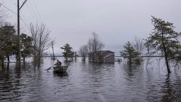
A man paddles over a flooded roadway on Grand Lake, N.B. as floodwaters continue to rise from the Saint John River on Tuesday, May 1, 2018. (Darren Calabrese/THE CANADIAN PRESS)
The notice affects an estimated 1,900 people.
The Red Cross has seen an increase of evacuations and requests for assistance from about 260 people on Wednesday to 388 people by Thursday morning, Downey said. The charity has opened shelters in Fredericton and Saint John, he said.
Authorities are urging residents who evacuate their houses to register with the Red Cross even if they don’t need assistance for now, Downey said.
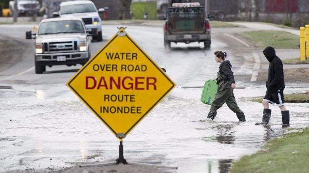
Authorities also warned residents to refrain from doing any recreational activities on the river such as kayaking or canoeing and also respect road closures.
“Roads are closed for a reason, for safety and we don’t need people ignoring that,” Downey said.
New Brunswick Premier Brian Gallant said he informed Prime Minister Justin Trudeau the province will be seeking federal disaster assistance.
With files from The Canadian Press and CBC News


For reasons beyond our control, and for an undetermined period of time, our comment section is now closed. However, our social networks remain open to your contributions.