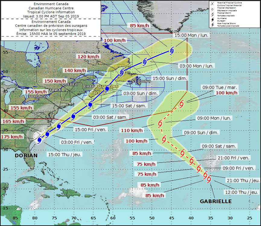
Hurricane Dorian is expected to barrel into Atlantic Canada this weekend as a Category 1 hurricane, churning out sustained winds up to 140 km/h when it reaches Nova Scotia on Saturday, according to the Canadian Hurricane Centre.
“There is two main threats: high winds and rainfall,” Doug Mercer, senior meteorologist at the Canadian Hurricane Centre, told Radio Canada International.
The storm will be coming in from North Carolina, where it’s currently tracking with sustained winds of 170 km/h offshore, Mercer said.
As Dorian moves towards Nova Scotia, into Canada’s southernmost waters, meteorologists expect the winds to weaken a bit but the hurricane will still pack winds of about 150 km/h as it approaches the coastline, Mercer said.
“The storm is going to move somewhere along the coast of Nova Scotia – at this point we’re thinking more towards the eastern half of Nova Scotia, near or east of Halifax,” Mercer said. “At that point when it’s making landfall the winds offshore are going to be 140 km/h and it will be gusting up at least up to 120 km/h along the coast.”
By noon on Sunday, the storm is expected to cross into the Gulf of St. Lawrence and it’s going to approach western Newfoundland with winds up to 120 km/h, Mercer said.
“That’s marginal Category 1 hurricane force,” he added.
(Canadian Hurricane Centre)
By Sunday evening, the storm is expected to move offshore, racing out across the Atlantic and ending up as a weak system near Iceland, Mercer said.
The Canadian Hurricane Centre expects that severe winds and rainfall will have major impacts for southeastern New Brunswick, Prince Edward Island, Nova Scotia, Western Newfoundland, and the Quebec Lower North Shore.
There will also be large waves, especially for the Atlantic coasts of Nova Scotia and Newfoundland and eastern portions of the Gulf of St. Lawrence, the centre said in its latest forecast.
Storm surge, combined with large waves and pounding surf, may have impacts for parts of Nova Scotia, Prince Edward Island, Newfoundland, and the Magdalen Islands, said Mercer.
Ferry service between Newfoundland and Labrador is expected to be disrupted due to high winds over the water and the high waves they generate during the peak of the storm, said Mercer.
“There will probably be a lot of marine warnings out Saturday into Sunday,” he added.
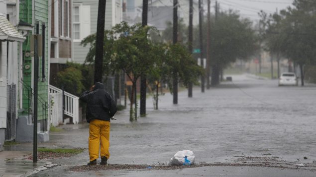
A man checks on flooding around his home along Aiken Street during Hurricane Dorian in Charleston, South Carolina, U.S., Sept. 5, 2019. Up to 150 mm of rain is expected in some parts of Atlantic Canada. (Randall Hill/REUTERS)
Rainfall will be a major factor and heavy rainfall will likely lead to flooding in the affected areas. The highest rainfall amounts are likely for western parts of Nova Scotia, Prince Edward Island, and the Gulf of St. Lawrence region where 50 to 100 mm is expected, Mercer said.
This comes on top of large quantities of rain brought by Post-tropical Storm Erin, which dumped anywhere between 80 to 160 mm of rain last week, Mercer said.
“So now we have a large area in western Nova Scotia where the soil is pretty close to saturated, and now we’re going to get upwards of another 150 mm of rain there,” Mercer said.
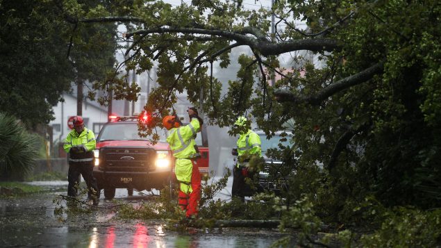
Authorities are worried that strong winds will simply uproot trees from the soft, saturated soil, he added.
“Basically the winds are strong enough to pull the roots right out of the ground,” Mercer said. “And if the trees come down and branches get broken off, power outages is going to be a big issue.”


For reasons beyond our control, and for an undetermined period of time, our comment section is now closed. However, our social networks remain open to your contributions.