The huge Rocher Percé (Percé Rock) off the Gaspé coast of Quebec juts out into the Atlantic.. Seen from this side, it appears solid and formidable.

The huge limestone Rocher Percé (Percé Rock) off the Gaspé coast of Quebec juts out into the Atlantic. Seen from this side, it appears solid and formidable.
Photo Credit: wiki commons

Iconic geographical sites eroding

They’ve been around for hundreds if not thousands of years, but the slow erosion seems to have picked up in recent years.

Several of Canada’s east coast fascinating quirks of nature are disappearing under an increasingly forceful nature.
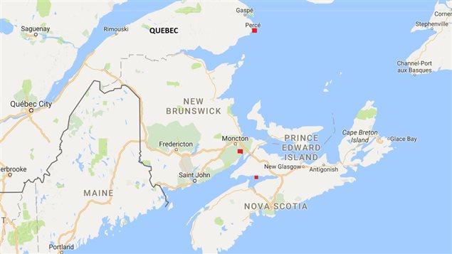
Red dots indicate Perce Rock in Quebec, Hopewell Rocks in New Brunswick, and Long Island, Nova Scottia. Coastal erosion is becoming a serious concern throughout Canada’s east coast.
Red dots indicate Perce Rock in Quebec, Hopewell Rocks in New Brunswick, and Long Island, Nova Scottia. Coastal erosion is becoming a serious concern throughout Canada’s east coast. © google

The slow process of coastal erosion has been attributed to climate change which is resulting in higher tides and more violent storms,

In some places where winter ice has historically protected shorelines such as in Prince Edward Island, warmer winters means less ice  and for shorter periods so that winter storms can batter the unprotected coastline.

In 2015, “the hole” a popular tourist and kayaking destination in Long Island Nova Scotia collapsed in the Minas Basin, in the Bay of Fundy.
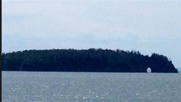
A view of the sea-arch at Long Island at high tide taken September 2015, about a month before it collapsed
A view of the sea-arch at Long Island at high tide taken September 2015, about a month before it collapsed © Daniel Irvin/Facebook

The bay between the New Brunswick and Nova Scotia is known to have some of the highest tides in the world, but storms are making the waves rougher, and the tides sometimes are reaching record heights.

Coastal erosion throughout Canada’s east coast maritime provinces ranges anywhere up to a metre per year of loss.
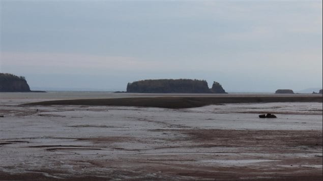
The collapsed arch of Long Island shown at low tide. The Bay of Fundy has some of the highest tides in the world. These can create strong erosion, but have been exacerbated by a changing climate in recent years.
The collapsed arch of Long Island shown at low tide. The Bay of Fundy has some of the highest tides in the world. These can create strong erosion, but erosion has been increasing due to a changing climate in recent years. © Harold Nesbittt via CBC

Another world famous site is known as the “Hopewell Rocks”  at the tip of the Bay of Fundy in New Brunswick. Formed by centuries of erosion, last year it was too much for one of the formations known as “elephant rock” and a large portion collapsed.
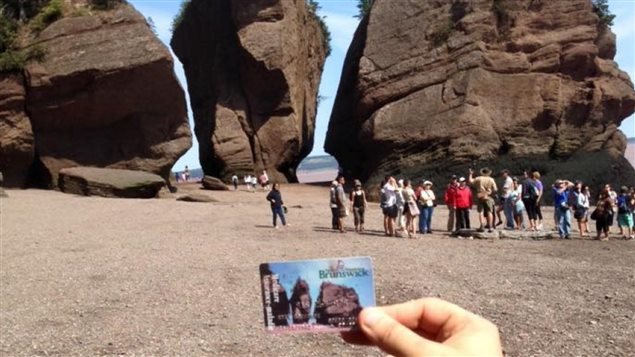
The New Brunswick Medicare card features the formerly-intact Elephant Rock in the middle
The New Brunswick Medicare card features the formerly-intact Elephant Rock in the middle © Courtesy of Mark Brewer

In May of this year, another section collapsed and has been roped off from tourists for safety reasons.
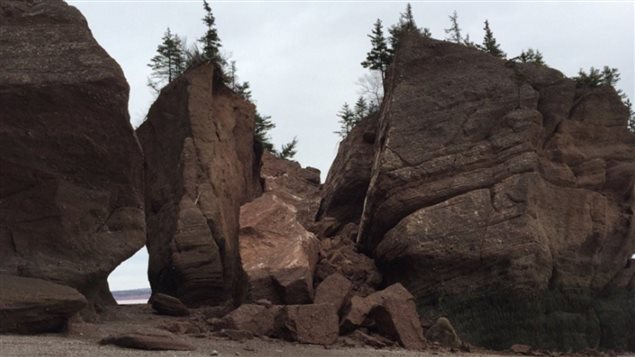
Elephant Rock, one of the most famous of the Flowerpot Rock formations at Hopewell Rocks, partially collapsed in March 2016
Elephant Rock, one of the most famous of the Flowerpot Rock formations at Hopewell Rocks, partially collapsed in March 2016 © Radio-Canada

Perhaps one of the most iconic geographical features is  Rocher Perce off Quebec’s Gaspe coast. Although in no immediate danger of collapse, there are not increasing concerns about how long that famous hole/archway will last.
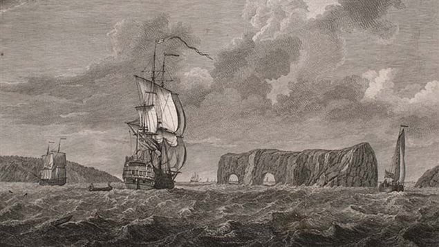
 *A view of the Pierced Island, a remarkable rock in the Gulf of St. Laurence—two leagues to the southward of Gaspée Bay* drawn by Captain Hervey Smyth, 1760; engraved by Pierre Charles Cannot 1768.
*A view of the Pierced Island, a remarkable rock in the Gulf of St. Laurence—two leagues to the southward of Gaspée Bay* drawn by Captain Hervey Smyth, 1760; engraved by Pierre Charles Cannot 1768. ©  Library of Congress USA/ Wiki commons

The huge feature 433 metres long, and 88 metres high once was even longer. The explorer Jacques Cartier noted in the 16th century that the feature had three arches.

The second arch collapsed and disappeared around 1845, leaving the current single arch and a large pillar which once joined the second arch.
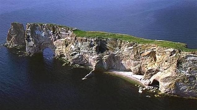
Viewed from the other side, one can sea the massive 88m high structure with its 20m arch, is not nearly so solid, and is increasingly vulnerable to erosion.
Viewed from the other side, one can sea the massive 88m high structure with its 15m arch is not nearly so solid, and is increasingly vulnerable to erosion. losing about 300t of rock annually. © wikimapia

Although under no immediate threat of disappearing with experts saying it’ll be around for another couple of centuries., the feature does lose about 300 tonnes of rock each year.

However with the added forces due to climate change, estimates are not quite as certain as they used to be.

Youtube video (Jean Letarte)

Additional information –sources

Categories: Environment & Animal Life, International
Tags: , , , , , ,

Do you want to report an error or a typo? Click here!

For reasons beyond our control, and for an undetermined period of time, our comment section is now closed. However, our social networks remain open to your contributions.