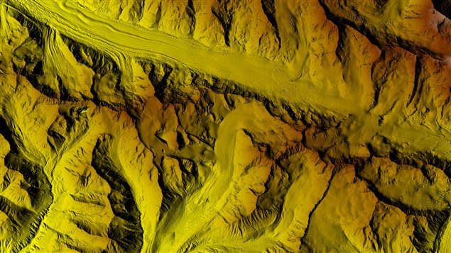
Following the public release of super-detailed 3-D topographic maps of Alaska last week, the United States government plans to gradually release similar maps covering the entire Arctic by the end of 2017, say officials with the National Geospatial-Intelligence Agency (NGA).
The 3-D digital elevation models, or DEMs, released by the NGA, which usually provides geospatial intelligence for the Pentagon and the Department of Homeland Security, were the first batch of maps to come from the ArcticDEM project created following an executive order by President Barack Obama in January 2015.
“We will be producing a second round of products that will include areas outside of Alaska, and I believe as far as Canada goes you’ll see some of the larger Queen Elizabeth islands in that release,” said Brian Bates, NGA Liaison to the National Science Foundation’s Polar Geospatial Center. “And then you will see a series of releases every couple of months until we have managed to circumnavigate the entire North Pole as well.”
(click to listen to the full interview with Brian Bates)
ListenThe plan is to collect and produce in collaboration with the National Science Foundation (NSF) and the Polar Geospatial Center at the University of Minnesota over the next year the first iteration of the entire polar region, Bates said. Researchers will then take another year to make additions and revisit certain areas of interest, he said.
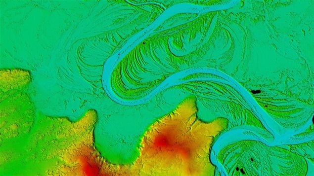
These high-resolution topographic maps available for public use at an open, unclassified Arctic portal, will help researchers and policy makers to monitor the rapidly changing Arctic environment – from rising sea levels, melting ice and glaciers to soil erosion, Bates said.
“These products will make not only excellent sources for scientific discovery and exploration but they are also practical for planning purposes for the folks living in the Arctic, folks looking in developing the Arctic,” Bates said. “As the ice changes, as the soil thaws, we’ve seen examples of erosion and soil giving away and so these products will capture some of that.”
The maps are the result of collaboration with the NSF, which funded the project, the White House Office of Science and Technology Policy, the Polar Geospatial Center at the University of Minnesota, University of Illinois, Ohio State University and Cornell University, Bates said.
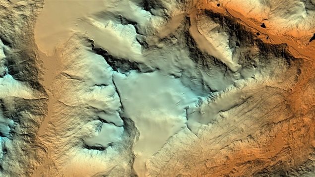
The models are based on 2-metre resolution images captured by Digital Globe commercial satellite, using an algorithm developed at Ohio State University.
In lower latitudes, researchers usually use air planes to gather imagery for mapping, but the vast Arctic with its harsh climate creates huge challenges for such traditional methods, and large areas of the Arctic had remained poorly mapped, Bates said.
Instead, U.S. researchers have had to rely on satellites to collect the necessary data, he said.
“This project, of course, aims to be for the entire Arctic region above 60 degrees latitude north and also include the Alaskan peninsula, the peninsula of Kamchatka, and southern Greenland and all of Iceland as well,” Bates said.
Over the last six years, researchers have collected data on most of the Arctic, Bates said.
“We still have some areas to go, some difficult challenging areas due to cloud cover,” he said. “But we are optimistic: if we haven’t collected them this season, which runs roughly from March to September, we will collect them next season.”


For reasons beyond our control, and for an undetermined period of time, our comment section is now closed. However, our social networks remain open to your contributions.