All across Canada, important battles and names of fallen Canadians have been remembered by naming certain geographical features.
These could be lakes, towns, islands, parks, mountains. etc
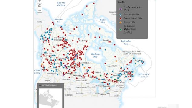
Now in time for the 100th anniversary of the end of the First World War, an interactive map showing all the place names of “remembrance” have been indicated.
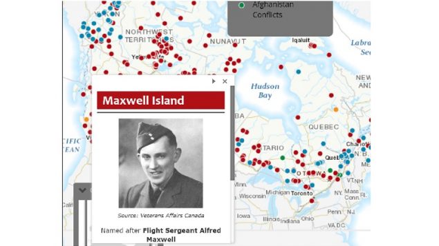
As an example, clicking on one of the red WWII dots brings up the place name and information on who ( or what) that geographical feature is named for. The small insets often have links to more information about the person or event. (Govt of Canada)
They are separated into the periods involved, i.e. all the places named in honour of WWI battles and fallen are shown on one map, wwII on another and so on. The first interactive map shows all such places together.
Clicking on one of the spots gives a brief story of the origin of the name (soldier or battle) and a link to more information.
To date there are 450 names on the map
Additional information


For reasons beyond our control, and for an undetermined period of time, our comment section is now closed. However, our social networks remain open to your contributions.