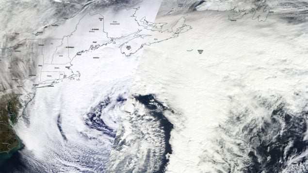
A new winter system is rolling through Canada’s Maritimes, with Newfoundland next in its path.
As the storm moves across the provinces, it will bring high winds and heavy snow.
Blizzard warnings cover all of Nova Scotia, which will be hit hardest by the strong winds and snowfall of more than 30 cm is possible along the Atlantic coastline, in the northeast of the mainland and Cape Breton.
Due to the strong winds, there will be a lot of snowdrifts.

And it won’t be over tomorrow morning: another weaker low pressure weather system will bring more snow to the province Tuesday night and very early Wednesday morning.
In addition, a blizzard warning has been issued by Environment Canada for the Avalon and the southern coast of Newfoundland for Tuesday.
Snow and blowing snow conditions are expected to develop overnight Monday, with strong northeasterly winds.
Conditions will continue into Tuesday as the low pressure system approaches the Avalon area.
In addition, winds are expected to gust as high as 90 km/h to create blizzard conditions with near zero visibility, Environment Canada warns.


For reasons beyond our control, and for an undetermined period of time, our comment section is now closed. However, our social networks remain open to your contributions.