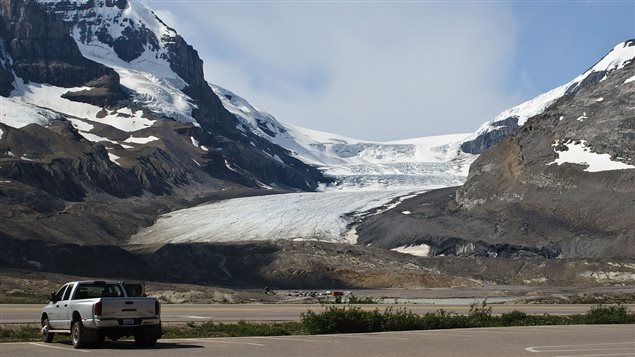
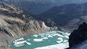
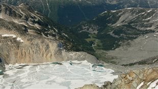
Canada’s western mountain chains are home to many of the world’s glaciers.
A new study indicates that due to human-influenced climate change, they are melting quickly, and could lose most of their volumes in just a few decades, with up to 70% disappearing completely.
Garry Clarke is the lead author of the research. He is a geophysicist, glaciologist, and professor emeritus in the Department of Earth, Ocean and Atmospheric Sciences at the University of British Columbia.
Listen
“The 70% (loss) gives a sense of false comfort” G Clarke
For thousands of years the glaciers in the mountains of British Columbia and Alberta have performed a vital ecological function. They store precipitation in winter, and then slowly release it throughout the hot summer. This provides cool fresh water for hundreds of major and minor river systems and lakes throughout the northwest of the continent.
Water for fish, birds, animals, and plants, and in very recent centuries, ranching and farming that helps feed the world.
Without glaciers mitigating effect and water reservoir, much of the western prairie could be far far drier with a major affect on all life there.
In addition, the rapidly melting (and not recovering) glaciers wil have a noticeable affect on sea level rise.
Professor Clarke says the situation could actually be worse than the 70% loss indicated in the study. He says the only reason it’s not close to a 100% loss of the provinces glaciers is due to a relatively small area in the mountains in the northwest corner of the province.
The study is the result of ten years work
In collaboration with researchers at the University of Iceland, the University of Victoria, the University of Northern British Columbia,and the Pacific Climate Impacts Consortium, professor Clarke incorporated the “flow physics” of ice and snow into a computer model of western Canada and its glaciers.
The model was begun at a point 2,000 years ago, and when run to the present day, the figures were compared to actual current figures as a verification of the model, and was shown to accurately predict the current state of the province’s glaciers.
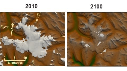
Professor Clarke and colleagues then ran the study model into future decades using two IPCC scenarios in a probable and worst case scenario from the latest annual report. Both scenarios portray a “bleak message” he says.
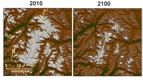
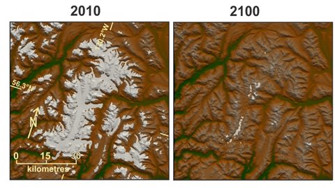
He points out that to the casual observer, there may be little difference to see in photos of a couple of decades ago, and the present, but that is deceptive. While the “area” of a glacier may appear similar, he says they are massively losing volume.
He says that other areas of the world such as South America and Central Asia are also seeing serious glacier loss with potentially even more serious consequences, and he would like to see the team’s research applied to help project scenarios there.
Abstract of the research in Nature Geoscience
Summary of the paper in Nature Geoscience


For reasons beyond our control, and for an undetermined period of time, our comment section is now closed. However, our social networks remain open to your contributions.